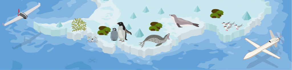
For the past nine months, the Online Duke team has been working on a new course series on unoccupied aircraft systems (UAS or drones), UAS Applications and Operations in Environmental Science, in partnership with the Nicholas School of the Environment (NSOE) and instructor Dave Johnston. The goal of the three-course series is for learners to be able to plan and fly successful drone missions that collect and analyze accurate environmental data.
Course Series Overview
| Introduction to UAS in Biology, Ecology, and Conservation Oct. 4-Nov. 15, 2021 | A survey of drone technology and research methodology; assumes that learners will have some familiarity with the course content, but may or may not have worked with drones before |
| UAS Operations for Environmental Scientists Jan. 10-Feb. 21, 2022 | Focuses on the regulatory and practical sides of planning and flying UAS operations |
| Quantitative Analysis of UAS Data Mar. 7-Apr. 18, 2022 | Gives hands-on experience with drone data and modern analytical software for assessing that data |
The Lead Instructor
“I was really interested in offering the course series because there are a lot of people who are starting to use drones for environmental science, and I feel like we’ve made pretty much all the mistakes that people can make, and so we [the MaRRS Lab] can help them avoid those mistakes,” Johnston says.
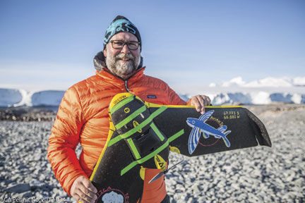
Johnston, who is an Associate Professor of the Practice of Marine Conservation & Ecology in the NSOE (Duke Environment) and the Director of the Marine Robotics and Remote Sensing (MaRRS) Lab at the Duke University Marine Laboratory, has a range of experience in environmental science, ranging from leading research projects for the National Oceanic and Atmospheric Administration (NOAA) to working as an ecologist within the non-governmental organization (NGO) sector. His current research focuses on advancing robotic applications, platforms, and sensors for marine science, education, and conservation missions. Johnston founded the MaRRS lab in August 2015, and his lab has been flying drones missions for environmental science for more than 8 years.
The Learners
The learners for the course series are environmental scientists looking to gain experience they can immediately apply to their work. For the pilot run of the course series, Johnston seeded learners for the course through collaborations with several key environmental science research organizations to offer scholarships for their employees. The first course enrolled 30 professionals predominantly from NOAA, the Southeast Coastal Ocean Observing Regional Association (SECOORA), and the Wildlife Conservation Society (WCS), among other organizations.
The Trip
As we started to get into intense production on the course, several members of the Online Duke team and media producer Mich Donovan from the Academic Media Services department traveled to the Duke Marine Lab in Beaufort to visit Johnston and meet some of the other course series instructors. After touring the Marine Lab’s campus and the MaRRS lab, we had some highly productive meetings to brainstorm and plan course activities, which reminded our completely remote team of some of the key advantages of working together in the same room.
The Activities
From early on, Johnston wanted to make the course series different and innovative, which led to discussions of how to gamify the course and come up with hands-on activities that reflected real-life professional experiences.
“Learning Innovation helped us design the curriculum from the ground up, helping us embrace entirely new ways to do assessment that are really well targeted for the demographic of people that we’re serving,” Johnston says. “And everything from the development of the Sakai site to video production… has been super professional and has really made the course what it is.”
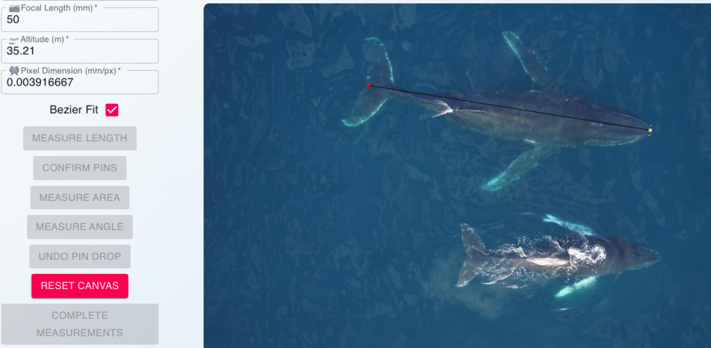
The first course includes a wide range of activities, from a paper airplane flight exercise and an asynchronous debate about the ethical implications of a drone project proposal, to manually counting seabirds and measuring the sizes of a whale mother and her calf in drone imagery. Learners also receive practical worksheets for drones projects that they can reuse when planning their own missions, including one worksheet to determine how drones can gather the type of data you need for scientific research, and another to determine what equipment you will need for a given type of drones application and how much you need budget for it.
The Games
Perhaps most popular among learners were the three interactive Twine games, in which learners navigated through drones missions with numerous pathways that required them to make decisions based on what they were learning in the course. These Twine games, which follow a narrative structure with text and images, allow learners to directly apply their knowledge to real-world scenarios based on the instructors’ and other researchers’ experiences using drones for environmental science (each game, in fact, has its own bibliography!).
“I learned a lot from the lectures and readings, but these games gave us the ability to apply our knowledge in real-world situations,” learner Wade Sedgwick says. “The Twine games pushed me to use the information I learned and apply it to different situations I may find myself in.”

For additional information about the Twine games, how they were created, and how you can use Twine to create educational games, check out this full blog post. You can also play a short demo of the Choose Your Drone … Wisely game.
The Conversation
Another core element of the course is the use of Discord, a chat, voice, and video call platform popular for live streaming, gaming, and tech communities, as a catch-all for reflecting about course activities, connecting with other learners and instructors, attending synchronous weekly class sessions, and informally sharing information. Learners report back on the results of the majority of their learning activities and often share additional information and research related to the activity’s topic, as well as ask questions. In addition, Discord is “gamified” in the course with a leaderboard that measures participation, and learners can join “teams” for their respective organizations.

Perhaps the most unique aspect of the use of Discord is that Johnston intends the Discord server (as specific channels/communities are called), The Flight Deck, as a place for connections and conversations to continue beyond the confines of the course series. Through Discord, learners have had more opportunities to connect and share in ways that would not have happened otherwise.
“The real highlight [of the first course] has been watching people from a really diverse set of backgrounds and geographic locations and agencies … truly engage with each other about class materials – and drones in general,” Johnston says. “The Discord site really captures that engagement … people don’t just show up and then disappear; they’re constantly touching base, and there’s a really strong heartbeat in the class. And that tells us that we’re on the right track with all of the things that we’re doing.”
(For a more detailed look at how Discord is used in the course, we will soon be publishing a deep-dive blog post about Discord in the Drones course series.)
The Videos
Thanks in large part to Johnston’s own creativity and interest in multimedia, the first course has immersive videos with rich multimedia content, from original graphics and data visualizations to a wealth of drone footage from actual missions. As Johnston explains course concepts, he shows examples of real-world operations and explains what’s going on. For media producer Donovan, these aspects have made it a particularly fun course to work on.
“I love Dave’s infectious excitement for this material, particularly by utilizing new and exciting technologies to create a unique learning experience,” says Donovan. “For a project with so much media, file management, and technical complexity due a remote workflow, his enthusiasm to try out new things and get hands-on with each part of the production process makes it a joy to tackle each challenge with him.”
Johnston also comes up with a range of ways to approach course videos so that each lecture isn’t the same routine. Some of his videos take the form of self-described “rants” about important topics, such as making professional terminology more inclusive (which is why you’ll see the term “unoccupied” rather than “unmanned” aircraft systems throughout the course). Further, Johnston mixes up the recording locations for fun and as it relates to the topic. In one video you may find him driving home from the Marine Lab while talking about the importance of gamification, while in another he’s in Kitty Hawk, North Carolina, where the Wright Brothers first flew, to give an overview of the history of aviation.
The videos also include equipment and software demonstrations, as well as a look at all the steps and planning that went into the planning of a mission to observe whales in Antarctica using drones, starting with the mission and moving backwards in time. For a sneak peak at one of the course videos, check out the following sample video that introduces the full course series.
The Sessions
The weekly synchronous sessions for the course also had a customized approach—Johnston adapts what he’s going to cover in the session based on how learners engage with the asynchronous content in the days leading up to the session. With this approach, learners get more relevant information and feedback that they can apply to their own contexts. Johnston also incorporates demonstrations into the sessions, and leaves plenty of time for Q&A so learners can get specific recommendations on everything from what drone to buy to best practices for data collection.
The Future
While we’ve received a lot of positive feedback about the course, it’s worth noting some of our lessons learned, particularly around the tools we selected and the course structure. While Discord was integral to learner engagement, we discovered that a number of learners had bandwidth issues during the live sessions and weren’t able to see the instructor’s video or shared screen. To address this issue, in later sessions we live-streamed the sessions through Discord and YouTube. Once we were live-streaming on multiple platforms, it became crucial to have two team members assisting with questions and technical issues.
Since many learners were in the field or at sea for some portion of the class, we gave learners flexible deadlines and more time to complete coursework after the final class session. We also encouraged learners to let us know ahead of time about any conflicts or challenges. Thankfully, we were aware of some of these potential issues from the start of the course from sending out a pre-course survey (see a template of the Getting to Know You survey we used).
All that being said, the course has been a joy for the team to work on, and the learner feedback has been really encouraging.
“Overall, I had a great time engaging in the course and participating through all the diverse interactive platforms,” learner Cielo Figuerola says. “I wish there were more courses adopting this model—students would have a much more productive and enjoyable experience.”
As we take what we’ve learned into the development of the second course, our team is reinvigorated by the collective enthusiasm, and we look forward to running the entire course sequence again beginning in fall 2022.
UAS Applications & Operations Course Series Team: Dave Johnston, Julian Dale, Alex Seymour, Justin Ridge, Salinda Bacheler, Troy Walton, Jon Putney, Jimmy Burch, Laura Lipps, Mich Donovan, Quentin Ruiz-Esparza, Hannah Rogers, Heather Valli, Michael Hudson, and Heather Hans.
Pingback: Recipe for an Online Course Series: Drones in Environmental Science (Duke Learning Innovation) | ResearchBuzz: Firehose
Pingback: World Resource Footprints, Virginia Deaf Culture, Spellbound Mystery Comics, More: Monday ResearchBuzz, December 13, 2021 – ResearchBuzz